List of species
-
Mallomonas
-
a
- Mallomonas acaroides
- Mallomonas acaroides var. inermis
- Mallomonas actinoloma
- Mallomonas actinoloma var. maramuresensis
- Mallomonas actinoloma var. nadiensis
- Mallomonas adamas
- Mallomonas akrokomos
- Mallomonas alata
- Mallomonas allorgei
- Mallomonas alphaphora
- Mallomonas alpina
- Mallomonas alveolata
- Mallomonas annulata
- Mallomonas areolata
-
b - c
- Mallomonas balonovii
- Mallomonas bangladeshica
- Mallomonas calceolus
- Mallomonas canina
- Mallomonas caudata
- Mallomonas clavus
- Mallomonas conspersa
- Mallomonas corcontica
- Mallomonas corymbosa
- Mallomonas costata
- Mallomonas crassisquama
- Mallomonas crassisquama var. papillosa
- Mallomonas cratis
- Mallomonas cristata
- Mallomonas cucullata
- Mallomonas cyathellata
- d - g
- h - k
-
l - m
- Mallomonas labyrinthina
- Mallomonas leboimei
- Mallomonas lelymene
- Mallomonas lychenensis
- Mallomonas lychenensis f. symposiaca
- Mallomonas maculata
- Mallomonas mangofera
- Mallomonas mangofera var. gracilis
- Mallomonas mangofera var. reticulata
- Mallomonas matvienkoae
- Mallomonas multisetigera
- Mallomonas multiunca
- Mallomonas munda
- o - ph
-
pi - pu
- Mallomonas pillula
- Mallomonas pillula f. exannulata
- Mallomonas pillula f. latimarginalis
- Mallomonas pillula f. valdiviana
- Mallomonas portae-ferreae
- Mallomonas prora
- Mallomonas pseudocoronata
- Mallomonas pseudocratis
- Mallomonas pugio
- Mallomonas pumilio
- Mallomonas pumilio var. dispersa
- Mallomonas punctifera
- Mallomonas punctifera var. brasiliensis
- r - s
- t - z
-
a
-
Synura
- a - g
- h - m
- n - u
- Neotessella
-
Paraphysomonas
- a - ci
- co - h
- i - q
- r - v
-
Lepidochromonas
- c - i
-
m - u
- Lepidochromonas manubriata
- Lepidochromonas morchella
- Lepidochromonas poteriophora
- Lepidochromonas quadrispina
- Lepidochromonas runcinifera
- Lepidochromonas sigillifera
- Lepidochromonas stelligera
- Lepidochromonas stephanolepis
- Lepidochromonas subquadrangularis
- Lepidochromonas subrotacea
- Lepidochromonas takahashii
- Lepidochromonas undulata
-
Spiniferomonas
- a - c
- m - t
- Chrysosphaerella
- Polylepidomonas
Search
General information
Description: Korshikov A.A. 1929: Studies on the Chrysomonads. I. - Arch. Protistenk. 67: 253-290.
Emend. Škaloud & Kynčlová 2012: 321.
Autecology: pH indifferent, tolerating higher water temperature.
Distribution: Northern temperate, widely distributed
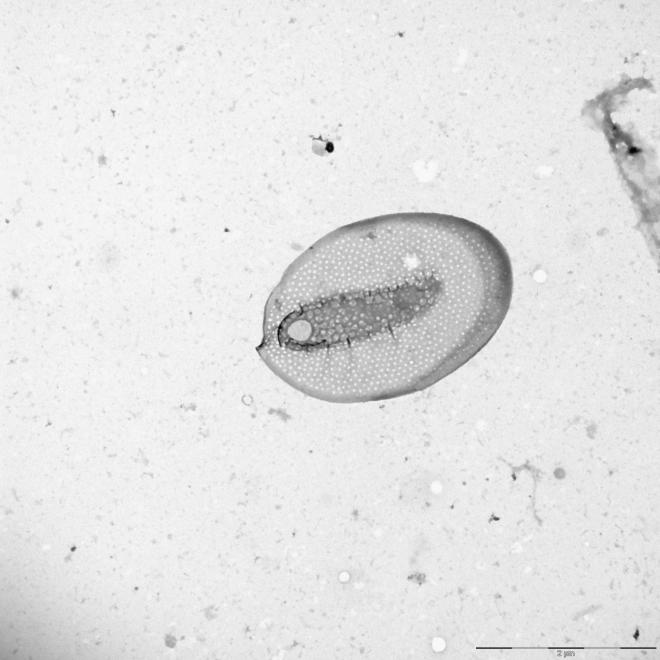
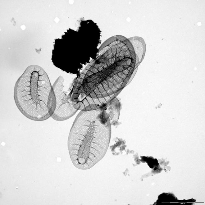
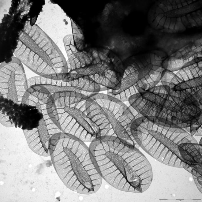
Image gallery
List of records
| Locality | Sampling date | pH | Conductivity (μS/cm) | Temperature (°C) | Coordinates | References |
|---|---|---|---|---|---|---|
| pool near Dyje river | 2007 | 48.676, 16.937 | SKALOUD et al. (2025) | |||
| Spalena Borkovna | 2021 | 6.6 | 126 | 48.9800389, 14.7994933 | SKALOUD et al. (2025) | |
| Ängersfjärden | 2012 | 5.8 | 89 | 15.5 | 63.593464, 19.836539 | NEMCOVA et al. some data (2016) |
| cutoff of the river Labe | 2014 | 7.4 | 307 | 20.0 | 50.361841, 15.910475 | CERTNEROVA (unpublished) |
| Lake Rahumeri | 2013 | 7.5 | 213 | 17.0 | 58.18243, 25.052464 | CERTNEROVA & SKALOUD (2020) |
| Lake Martiska | 2013 | 7.8 | 127 | 18.0 | 59.263996, 27.570443 | CERTNEROVA & SKALOUD (2020) |
| The river Raudna jogi | 2013 | 7.9 | 377 | 13.0 | 58.451234, 25.038077 | CERTNEROVA & SKALOUD (2020) |
| Lake Suur Linajarv | 2013 | 7.4 | 340 | 15.0 | 58.876229, 26.2743 | CERTNEROVA & SKALOUD (2020) |
| Saarijärvi | 2012 | 6.5 | 6.0 | 62.70173, 25.26388 | SKALOUD et al. (2014) | |
| Rybinskoye Vodokhranilishche, reservoir | 1968 | 58.433358, 38.086853 | BALONOV (1976) |
Distribution map
pool near Dyje river
Locality:
pool near Dyje river
Coordinates:
48.676, 16.937
Spalena Borkovna
Locality:
Spalena Borkovna
Coordinates:
48.9800389, 14.7994933
Ängersfjärden
Locality:
Ängersfjärden
Coordinates:
63.593464, 19.836539
cutoff of the river Labe
Locality:
cutoff of the river Labe
Coordinates:
50.361841, 15.910475
Lake Rahumeri
Locality:
Lake Rahumeri
Coordinates:
58.18243, 25.052464
Lake Martiska
Locality:
Lake Martiska
Coordinates:
59.263996, 27.570443
The river Raudna jogi
Locality:
The river Raudna jogi
Coordinates:
58.451234, 25.038077
Lake Suur Linajarv
Locality:
Lake Suur Linajarv
Coordinates:
58.876229, 26.2743
Saarijärvi
Locality:
Saarijärvi
Coordinates:
62.70173, 25.26388
Rybinskoye Vodokhranilishche, reservoir
Locality:
Rybinskoye Vodokhranilishche, reservoir
Coordinates:
58.433358, 38.086853
Schwarzsee
Locality:
Schwarzsee
Coordinates:
47.456155, 12.366958
Gieringer Weiher
Locality:
Gieringer Weiher
Coordinates:
47.4707, 12.3626
Hechtsee
Locality:
Hechtsee
Coordinates:
47.609056, 12.165298
brackish water of Pojo Bay
Locality:
brackish water of Pojo Bay
Coordinates:
60.041875, 23.493462
Mühlenaue
Locality:
Mühlenaue
Coordinates:
53.61639, 10.416884
Grossensee
Locality:
Grossensee
Coordinates:
53.621328, 10.348091
fishpomds Manhagen
Locality:
fishpomds Manhagen
Coordinates:
53.662429, 10.26078
Sphagnum pools
Locality:
Sphagnum pools
Coordinates:
53.84126, 10.233432
Spadenländer Ausschlaggraben
Locality:
Spadenländer Ausschlaggraben
Coordinates:
53.492284, 10.060859
river Elbe, Dove Elbe at Ruschort
Locality:
river Elbe, Dove Elbe at Ruschort
Coordinates:
53.499764, 10.068326
Elbe river at Spadenland
Locality:
Elbe river at Spadenland
Coordinates:
53.487382, 10.052233
pond
Locality:
pond
Coordinates:
53.464292, 9.82285
water reserve basin Pulverhof
Locality:
water reserve basin Pulverhof
Coordinates:
53.596529, 10.135896
Sphagnum pool in nature reserve Stellmoorer Tunneltal
Locality:
Sphagnum pool in nature reserve Stellmoorer Tunneltal
Coordinates:
53.623047, 10.187995
water reserve basin in nature reserve Stellmoorer Tunneltal
Locality:
water reserve basin in nature reserve Stellmoorer Tunneltal
Coordinates:
53.621099, 10.185957
Moorbek
Locality:
Moorbek
Coordinates:
53.653156, 10.198334
drain in Wohldorfer forest
Locality:
drain in Wohldorfer forest
Coordinates:
53.71035, 10.14086
ponds in the park Teichwiesen, Volksdorf
Locality:
ponds in the park Teichwiesen, Volksdorf
Coordinates:
53.65171, 10.153059
alluvial pool, Modrany, Prague
Locality:
alluvial pool, Modrany, Prague
Coordinates:
49.995212, 14.402631
peatbog Swamp NP, North Bohemia
Locality:
peatbog Swamp NP, North Bohemia
Coordinates:
50.576506, 14.669538
confluence of the Morava and Dyje rivers
Locality:
confluence of the Morava and Dyje rivers
Coordinates:
48.625477, 16.952677
Kyjsky pond, Prague
Locality:
Kyjsky pond, Prague
Coordinates:
50.099496, 14.546156
Hutsky pond, Novohradske Hory
Locality:
Hutsky pond, Novohradske Hory
Coordinates:
48.65531, 14.682283
pond Lichterfelde, Botanical garden, Berlin
Locality:
pond Lichterfelde, Botanical garden, Berlin
Coordinates:
52.452531, 13.307018
Nikolassee
Locality:
Nikolassee
Coordinates:
52.424146, 13.192077
Moorweiher in Bärnau
Locality:
Moorweiher in Bärnau
Coordinates:
49.81085, 12.433949
Feisnitzspeicher
Locality:
Feisnitzspeicher
Coordinates:
50.034265, 12.17783
Silbersee
Locality:
Silbersee
Coordinates:
49.412481, 12.596984
Pfreimdtalsperre
Locality:
Pfreimdtalsperre
Coordinates:
49.52298, 12.282028
Kainzmühlspeicher
Locality:
Kainzmühlspeicher
Coordinates:
49.574657, 12.297907
Sidiyambtosio Lake
Locality:
Sidiyambtosio Lake
Coordinates:
68.116667, 65.5
Ochety Lake st. 1, Basin of Kara River
Locality:
Ochety Lake st. 1, Basin of Kara River
Coordinates:
68.124722, 65.826694
Brejo de Segadães, ditch
Locality:
Brejo de Segadães, ditch
Coordinates:
40.605922, -8.491234
Portela, reservoir of river Mondego
Locality:
Portela, reservoir of river Mondego
Coordinates:
40.185037, -8.394785
lake Ozeros and adjacent pond
Locality:
lake Ozeros and adjacent pond
Coordinates:
38.656829, 21.223125
undefined localities (approx. coord.)
Locality:
undefined localities (approx. coord.)
Coordinates:
61.543641, 25.422363
Tystrup Sø
Locality:
Tystrup Sø
Coordinates:
55.369356, 11.570606
Erpewaai IV
Locality:
Erpewaai IV
Coordinates:
51.761054, 5.827293
Erpewaai III
Locality:
Erpewaai III
Coordinates:
51.761054, 5.827293
Loampit near Udenhout, pond
Locality:
Loampit near Udenhout, pond
Coordinates:
51.608903, 5.182114
ditch system near Haarsteegse Wiel, pH 6.3.-7.9
Locality:
ditch system near Haarsteegse Wiel, pH 6.3.-7.9
Coordinates:
51.718946, 5.18383
small pool near Shayk (Shaijk)
Locality:
small pool near Shayk (Shaijk)
Coordinates:
51.741433, 5.632467
Broekse Wielen IV., pond near the river Meuse
Locality:
Broekse Wielen IV., pond near the river Meuse
Coordinates:
51.728889, 5.763788
Bosbeek, a brook about 1 km from its origin
Locality:
Bosbeek, a brook about 1 km from its origin
Coordinates:
51.171244, 6.107883
moorland pools Hatertse and Overasseltse Vennen, Bavoven
Locality:
moorland pools Hatertse and Overasseltse Vennen, Bavoven
Coordinates:
51.78425, 5.805845
pond E of the Oude Waal
Locality:
pond E of the Oude Waal
Coordinates:
51.855052, 5.897727
Immerlooplas
Locality:
Immerlooplas
Coordinates:
51.955189, 5.91485
pond F of the Oude Waal, pH neutral to slightly alkaline
Locality:
pond F of the Oude Waal, pH neutral to slightly alkaline
Coordinates:
51.855847, 5.900259
pond D of the Oude Waal, pH neutral to slightly alkaline
Locality:
pond D of the Oude Waal, pH neutral to slightly alkaline
Coordinates:
51.853091, 5.896783
pond D of the Oude Waal, pH neutral to slightly alkaline
Locality:
pond D of the Oude Waal, pH neutral to slightly alkaline
Coordinates:
51.853091, 5.896783
roadside Caricetum I. (temporary water)
Locality:
roadside Caricetum I. (temporary water)
Coordinates:
47.584371, 21.128297
Hortobágy, fish breeding pond
Locality:
Hortobágy, fish breeding pond
Coordinates:
47.609404, 21.065254
Hortobágy, large fishpond
Locality:
Hortobágy, large fishpond
Coordinates:
47.609404, 21.065254
Debrecen-Hortobágy road (no. 33) 96th km section, reservoir
Locality:
Debrecen-Hortobágy road (no. 33) 96th km section, reservoir
Coordinates:
47.559905, 21.453209
Vorkuta tundra, pond Vorgashor
Locality:
Vorkuta tundra, pond Vorgashor
Coordinates:
67.583333, 63.783333
Kharbey, small pond
Locality:
Kharbey, small pond
Coordinates:
67.538475, 62.745544
Province of Gelderland, Watertower Wychen
Locality:
Province of Gelderland, Watertower Wychen
Coordinates:
51.816198, 5.703092
Province of Gelderland, Molenwiel
Locality:
Province of Gelderland, Molenwiel
Coordinates:
51.770605, 5.754626
Province of Gelderland, Erpewaai IV
Locality:
Province of Gelderland, Erpewaai IV
Coordinates:
51.761054, 5.827293
Province of Gelderland, Erpewaai III
Locality:
Province of Gelderland, Erpewaai III
Coordinates:
51.761054, 5.827293
Province of Gelderland, Erpewaai II
Locality:
Province of Gelderland, Erpewaai II
Coordinates:
