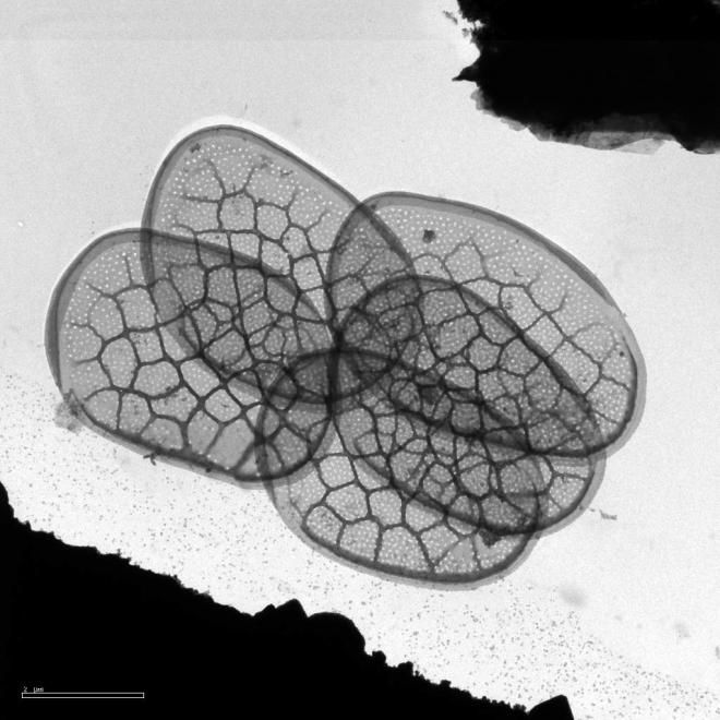
List of species
-
Mallomonas
-
a
- Mallomonas acaroides
- Mallomonas acaroides var. inermis
- Mallomonas actinoloma
- Mallomonas actinoloma var. maramuresensis
- Mallomonas actinoloma var. nadiensis
- Mallomonas adamas
- Mallomonas akrokomos
- Mallomonas alata
- Mallomonas allorgei
- Mallomonas alphaphora
- Mallomonas alpina
- Mallomonas alveolata
- Mallomonas annulata
- Mallomonas areolata
-
b - c
- Mallomonas balonovii
- Mallomonas bangladeshica
- Mallomonas calceolus
- Mallomonas canina
- Mallomonas caudata
- Mallomonas clavus
- Mallomonas conspersa
- Mallomonas corcontica
- Mallomonas corymbosa
- Mallomonas costata
- Mallomonas crassisquama
- Mallomonas crassisquama var. papillosa
- Mallomonas cratis
- Mallomonas cristata
- Mallomonas cucullata
- Mallomonas cyathellata
- d - g
- h - k
-
l - m
- Mallomonas labyrinthina
- Mallomonas leboimei
- Mallomonas lelymene
- Mallomonas lychenensis
- Mallomonas lychenensis f. symposiaca
- Mallomonas maculata
- Mallomonas mangofera
- Mallomonas mangofera var. gracilis
- Mallomonas mangofera var. reticulata
- Mallomonas matvienkoae
- Mallomonas multisetigera
- Mallomonas multiunca
- Mallomonas munda
- o - ph
-
pi - pu
- Mallomonas pillula
- Mallomonas pillula f. exannulata
- Mallomonas pillula f. latimarginalis
- Mallomonas pillula f. valdiviana
- Mallomonas portae-ferreae
- Mallomonas prora
- Mallomonas pseudocoronata
- Mallomonas pseudocratis
- Mallomonas pugio
- Mallomonas pumilio
- Mallomonas pumilio var. dispersa
- Mallomonas punctifera
- Mallomonas punctifera var. brasiliensis
- r - s
- t - z
-
a
-
Synura
- a - g
- h - m
- n - u
- Neotessella
-
Paraphysomonas
- a - ci
- co - h
- i - q
- r - v
-
Lepidochromonas
- c - i
-
m - u
- Lepidochromonas manubriata
- Lepidochromonas morchella
- Lepidochromonas poteriophora
- Lepidochromonas quadrispina
- Lepidochromonas runcinifera
- Lepidochromonas sigillifera
- Lepidochromonas stelligera
- Lepidochromonas stephanolepis
- Lepidochromonas subquadrangularis
- Lepidochromonas subrotacea
- Lepidochromonas takahashii
- Lepidochromonas undulata
-
Spiniferomonas
- a - c
- m - t
- Chrysosphaerella
- Polylepidomonas
Search
General information
Description: Conrad, W. (1927): Essai d'une monographie des genres Mallomonas Perty (1852) et Pseudomallomonas Chodat (1920). - Arch. Protistenk. 59: 423-505.
Autecology: mesotrophic to eutrophic, prefers cold water.
Distribution: Northern temperate, incl. arctic.
Image gallery
List of records
| Locality | Sampling date | pH | Conductivity (μS/cm) | Temperature (°C) | Coordinates | References |
|---|---|---|---|---|---|---|
| canal of Sutka river | 2019 | 8.5 | 152 | 7.6 | 58.049256, 38.251608 | KAPUSTIN (unpublished) |
| 1981 | 7.2 | 340 | 19.0 | DÜRRSCHMIDT (1984) | ||
| Schönwalder Allee, pond | 52.584017, 13.164439 | GUTOWSKI (1997) | ||||
| Rückertteich | 52.461265, 13.305427 | GUTOWSKI (1997) | ||||
| Rohrpfuhl | 52.597678, 13.161263 | GUTOWSKI (1997) | ||||
| Kuhlake, ditch | 52.572959, 13.171098 | GUTOWSKI (1997) | ||||
| Kuhlake, pond | 52.564404, 13.194144 | GUTOWSKI (1997) | ||||
| river Havel at Glienicke | 52.422314, 13.093929 | GUTOWSKI (1997) | ||||
| river Havel at Schildhorn | 52.496369, 13.191776 | GUTOWSKI (1997) | ||||
| Fauler See, Spandau | 52.519981, 13.214564 | GUTOWSKI (1997) |
Distribution map
canal of Sutka river
Locality:
canal of Sutka river
Coordinates:
58.049256, 38.251608
Schönwalder Allee, pond
Locality:
Schönwalder Allee, pond
Coordinates:
52.584017, 13.164439
Rückertteich
Locality:
Rückertteich
Coordinates:
52.461265, 13.305427
Rohrpfuhl
Locality:
Rohrpfuhl
Coordinates:
52.597678, 13.161263
Kuhlake, ditch
Locality:
Kuhlake, ditch
Coordinates:
52.572959, 13.171098
Kuhlake, pond
Locality:
Kuhlake, pond
Coordinates:
52.564404, 13.194144
river Havel at Glienicke
Locality:
river Havel at Glienicke
Coordinates:
52.422314, 13.093929
river Havel at Schildhorn
Locality:
river Havel at Schildhorn
Coordinates:
52.496369, 13.191776
Fauler See, Spandau
Locality:
Fauler See, Spandau
Coordinates:
52.519981, 13.214564
Ivankovo Reservoir
Locality:
Ivankovo Reservoir
Coordinates:
56.753476, 37.096267
Trummen
Locality:
Trummen
Coordinates:
56.862675, 14.830334
Flaten
Locality:
Flaten
Coordinates:
59.250744, 18.154292
Lebrader Teich
Locality:
Lebrader Teich
Coordinates:
54.220536, 10.428421
Heidensee
Locality:
Heidensee
Coordinates:
54.139563, 10.473139
lake Trummen
Locality:
lake Trummen
Coordinates:
56.862018, 14.829819
Eixendorfer Speicher
Locality:
Eixendorfer Speicher
Coordinates:
49.339441, 12.445965
lake Laduviken
Locality:
lake Laduviken
Coordinates:
59.360758, 18.077488
Lake Trummen
Locality:
Lake Trummen
Coordinates:
56.861197, 14.831758
Kis-Jusztus swamp, temporary
Locality:
Kis-Jusztus swamp, temporary
Coordinates:
47.57502, 21.022854
alluvial pools, Lužnice River
Locality:
alluvial pools, Lužnice River
Coordinates:
48.835123, 14.927174
alluvial pools, Lužnice River, Mallomonas in years 2000-2003
Locality:
alluvial pools, Lužnice River, Mallomonas in years 2000-2003
Coordinates:
48.810255, 14.930763
Égeres, small temporary forest pond, Pilis/Visegrád Mountains, Király-valley (approx.)
Locality:
Égeres, small temporary forest pond, Pilis/Visegrád Mountains, Király-valley (approx.)
Coordinates:
47.74, 18.92
Bøgeholm Sø
Locality:
Bøgeholm Sø
Coordinates:
56.062812, 12.532003
Sortesø
Locality:
Sortesø
Coordinates:
56.047308, 12.5559
Bondedam
Locality:
Bondedam
Coordinates:
56.061638, 12.54869
Kobberdam
Locality:
Kobberdam
Coordinates:
56.058715, 12.557788
János Pond, Visegrád mountains
Locality:
János Pond, Visegrád mountains
Coordinates:
47.71364, 19.01981
small bog pond in the Visegrád mountains
Locality:
small bog pond in the Visegrád mountains
Coordinates:
47.713521, 19.040333
small bog pond in the middle of an alder forest, Visegrád mountains
Locality:
small bog pond in the middle of an alder forest, Visegrád mountains
Coordinates:
47.707497, 19.040247
Hestehavedam
Locality:
Hestehavedam
Coordinates:
55.241466, 14.790577
Trummen - eutrophic-polluted lake
Locality:
Trummen - eutrophic-polluted lake
Coordinates:
56.851225, 14.781218
sediment core, lake Röyrtjörna
Locality:
sediment core, lake Röyrtjörna
Coordinates:
64.668863, 12.178974
Geuldert, Helbeek , pH 5.9-7.3
Locality:
Geuldert, Helbeek , pH 5.9-7.3
Coordinates:
51.737651, 5.929827
Tystrup-Bavelse lakes, Zealand
Locality:
Tystrup-Bavelse lakes, Zealand
Coordinates:
55.363503, 11.5765
Tystrup Sø
Locality:
Tystrup Sø
Coordinates:
55.369356, 11.570606
ditch system near Haarsteegse Wiel, pH 6.3.-7.9
Locality:
ditch system near Haarsteegse Wiel, pH 6.3.-7.9
Coordinates:
51.718946, 5.18383
Broekse Wielen II., pond near the river Meuse
Locality:
Broekse Wielen II., pond near the river Meuse
Coordinates:
51.728889, 5.763788
Broekse Wielen I., pond near the river Meuse
Locality:
Broekse Wielen I., pond near the river Meuse
Coordinates:
51.728889, 5.763788
Szeremlei holtág, a sluice on backwater of the R. Danube at Baja city
Locality:
Szeremlei holtág, a sluice on backwater of the R. Danube at Baja city
Coordinates:
46.168874, 18.941966
peat bog Tau cu botile near Salicea, spring
Locality:
peat bog Tau cu botile near Salicea, spring
Coordinates:
46.678387, 23.527885
eutrophic bog, Mestecănişul de la Reci
Locality:
eutrophic bog, Mestecănişul de la Reci
Coordinates:
45.822582, 25.926525
eutrophic bog, Mestecănişul de la Reci
Locality:
eutrophic bog, Mestecănişul de la Reci
Coordinates:
45.822582, 25.926525
Baláta-tó, bog lake complex, shallow waters among sedge humocks and floating peat islands, after ice melting
Locality:
Baláta-tó, bog lake complex, shallow waters among sedge humocks and floating peat islands, after ice melting
Coordinates:
46.311011, 17.207508
Hortobágy, large fishpond
Locality:
Hortobágy, large fishpond
Coordinates:
47.609404, 21.065254
Debrecen-Hortobágy road (no. 33) 96th km section, reservoir
Locality:
Debrecen-Hortobágy road (no. 33) 96th km section, reservoir
Coordinates:
47.559905, 21.453209
Province of Limburg, Geuldert
Locality:
Province of Limburg, Geuldert
Coordinates:
51.737651, 5.929827
Province of Gelderland, Erpewaai II
Locality:
Province of Gelderland, Erpewaai II
Coordinates:
51.761054, 5.827293
T2 pool
Locality:
T2 pool
Coordinates:
48.835123, 14.927174
T2 pool
Locality:
T2 pool
Coordinates:
48.835123, 14.927174
T2 pool
Locality:
T2 pool
Coordinates:
48.835123, 14.927174
T2 pool
Locality:
T2 pool
Coordinates:
48.835123, 14.927174
Vezak pond
Locality:
Vezak pond
Coordinates:
